 www.gein.noa.gr/services/kith.html
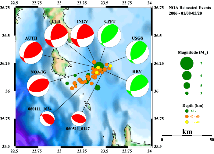
This map displays data that is gathered about earthquakes and there occurrences off the shores of Greece. The data is displayed on a map that is known as a range graded map because there are only four types, or in this case magnitudes, of earthquakes, that are being recognized. This map can be seen as important because it is able to lay a "concrete" visual system for how to classify many events in one area. Although there might be many variations in magnitudes, some varying only on a very small scale, in this type of map, the proportional circles are only allowed to classified into one of four categories, cutting down on the confusion and "guessing" that could go into classifying the earthquakes. This is important because it makes this type of map a little more "universal," simply to the extent that people could agree on a 6 or 7 magnitude earthquake as catastrophic. If there were not such defined categories, perhaps a 6.3 in an area with many earthquakes would not be in the worst range, however, in a place where there are only a few, it would.
No comments:
Post a Comment