 www-das.uwyo.edu/.../chap13/coastal_rain.html
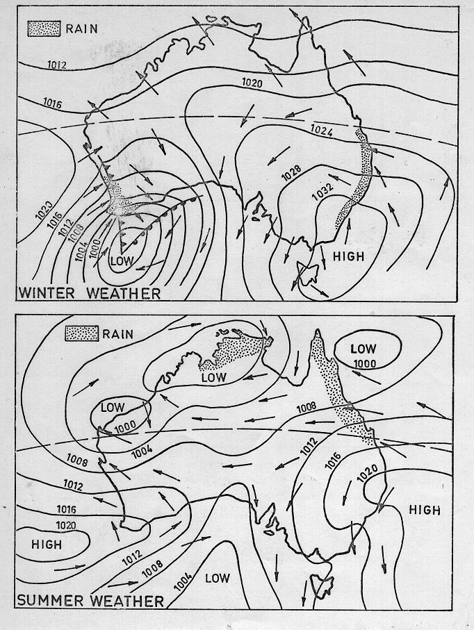
 This map is an isobar map that illustrates how similar pressures are experienced throughout a country in different places on any particular day. This map explains how even in one country there can be very different pressures and, as a result, lots of different weather and forecasts. In these two images, pressures that are the same are connected by lines which, in most cases, end up encircling either an area of extremely high or low pressure. This map is important because it is able to contrast two different seasons in Australia and, because of it, shows how the rainfall, and other weather, can change.
No comments:
Post a Comment